
Monday, November 11, 2013
Comment on US Bike Route 1 study

The route follows a key corridor through which several bike routes pass: US Bike Route 1, Adventure Cycling Atlantic Coast Route, East Coast Greenway, and Potomac Heritage National Scenic Trail. The official route was effectively closed when Woodlawn Road was closed after 9/11, and there are few good alternatives. If you are familiar with this area and want to weigh in on possible routes, visit the Virtual Meeting site and provide comments.
From the presentation:
US Bike Route 1 was established in 1982. Due to new development in Northern Virginia, the current routing of USBR1 needs to be re-evaluated along with any possible alternatives. The project study area extends from the 14th Street Bridge in Arlington County to the southern boundary of Prince William County. This study includes conversations with jurisdictions, an on-road inspection, a Level of Service (LOS) analysis, a detailed signing plan and cost estimates for future implementation.
The following draft maps identify the current route as shown on VDOT's website, as well as several alternatives that are currently under consideration. Please share your thoughts on these routes via the electronic comment forms (found after each map). Your responses will be recorded as you go. Alternatively, you can email comments to: christopher.chop@mbakercorp.com. The deadline for comment is Monday, December 16th.
The following draft maps identify the current route as shown on VDOT's website, as well as several alternatives that are currently under consideration. Please share your thoughts on these routes via the electronic comment forms (found after each map). Your responses will be recorded as you go. Alternatively, you can email comments to: christopher.chop@mbakercorp.com. The deadline for comment is Monday, December 16th.
Labels: U.S. bike route system, US Bike Route 1
Saturday, October 6, 2012
VDOT releases updated Bicycling in Virginia map
VDOT recently released an updated version of the state bike map, Bicycling in Virginia. The map shows major bike routes in the state, including United States Bicycle Routes (USBR) 1 & 76, Skyline Drive, Blue Ridge Parkway, the Virginia Capital Trail, and a few other major trails. There is a Northern Virginia inset showing details of USBR 1, the Fairfax Co Parkway Trail, the Cross County Trail and others.Unfortunately there is so little road detail that the map can't be used for navigating any of these routes. The FFX Co Parkway trail is shown incorrectly in a couple of places, including showing that it crosses I-66 parallel to the Parkway. In that section there is an unsigned detour away from the Parkway.
 |
| USBR 1 on Bicycling in Virginia map |
This is what USBR 1 looks like on the VDOT website online map. As you can see, there are major differences between the two maps:
 |
| USBR 1 on VDOT online map |
The map could include some of the major routes in Northern Virginia that are identified on the Arlington, Alexandria, and Fairfax bike maps.
Labels: bicycling in Virginia map, U.S. bike route system, vdot
Friday, November 18, 2011
Cyclists turn out for Mt. Vernon area bike plan meeting
 |
| Bob Patten (left) taking notes on local bike conditions. |
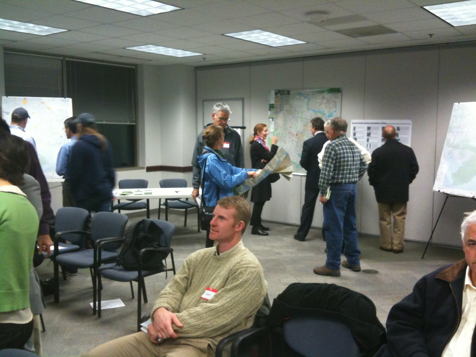
Bicycle Master Plan meeting for the greater Mt. Vernon area last night. Representatives from VDOT, Fairfax Co., and the Board of Supervisors attended as did members of FABB.
After cyclists studied and commented on detailed maps of the area, Bob Patten of Toole Design gave an overview of the master planning process. He also described several types of bicycle facilities such as cycletracks, buffered bike lanes, shared lane markings (sharrows), and others.
Bob stated that the plan will result in a map showing specific facilities proposed for roads in the county. There will also be policy recommendations to ensure that county policies treat bicycling as an integral part of the transportation system. These not only include bike route facilities but also bike parking requirements, opportunities for bicycle safety education at all levels, improved enforcement, and encouragement of bicycling by using such measures as transportation demand management incentives.
Several natural and manmade barriers make cycling in this area a challenge. Route 1 is the biggest challenge. Few cyclists choose to ride with 45 mph traffic and there are almost no side paths along the road. Many of the surrounding neighborhood streets don't connect, especially on the south side.
Just north of Route 1, Huntley Meadows Park and Fort Belvoir form another barrier. For a 2 mile stretch just north of Mt. Vernon Estate, Little Hunting Creek is a major barrier between several residential neighborhoods, forcing cyclists to use either the Mt. Vernon Trail or Route 1.
There are several major attractions in the area including Mt. Vernon Estate, Mason Neck State Park and Natural Wildlife Refuge, Pohick Bay Regional Park, Huntley Meadows Park, and Fort Hunt National Park. U.S. Bike Route 1, the East Coast Greenway, and the Adventure Cycling Atlantic Coast route all pass through this area. The area could be a major cycling destination if there were good bicycle routes connecting major attractions. It's going to take the work of everyone to make this happen.
Labels: bicycle master plan, east coast greenway, mt. vernon, route 1, U.S. bike route system
Saturday, March 12, 2011
US Bike Route 1 meeting

Any changes to the route must be approved by AASHTO. Currently there are only two official US Bike Routes, USBR 1 extending from Virginia thru North Carolina, and USBR 76 extending from Virginia to Illinois. Adventure Cycling Association is leading development of a complete network of US bike routes, extending the existing routes to the national border and creating several other cross-U.S. routes.
The USBR 1 meeting was mostly a discussion of the status of the route through the states north of VA and south of NC, and changes to the VA and NC segments. In VA the route through Ft. Belvoir has been closed since Woodlawn Rd was closed to through traffic after September 11 (map). A new road, Mulligan Road, is being built that will extend across Ft. Belvoir from Route 1 to Telegraph Rd that will be open to bike traffic with wide outside lanes and a shared use path. According to VDOT, construction of Mulligan Rd will be complete in 2012.
The alignment of USBR 1 as it enters VA from the north was also discussed. Documentation of the official route is being sought to determine if it enters VA using the Arlington Memorial Bridge or the 14th Street bridge. With the Memorial bridge crossing cyclists ride along a paved trail leading to the Mt Vernon Trail. This connector trail crosses fast moving traffic at two places, the entrance ramp from Washington Blvd, and GW Parkway. The 14th Street crossing has a more direct connection to the Mt Vernon Trail.

Labels: U.S. bike route system
Thursday, August 19, 2010
Telegraph Road public hearing
 |
| Section of Vicinity map |
VDOT plans to modify the two-lane section by adding several new turn lanes, bike lanes, a shared use path on one side and a sidewalk on the other. With two busy roads on either end of the project, there are many turning movements and safely routing bike lanes through traffic will be a challenge. See the VDOT Telegraph Rd project web page that includes a vicinity map.
VDOT recently announced that the public hearing will be held on September 23 from 5-8 p.m. at Hayfield Secondary School, 7630 Telegraph Rd, Alexandria, 22315. We will review the plans at VDOT headquarters and will be preparing comments for the public hearing. This is an important part of the bicycle network for Fairfax County. Bike lanes on Telegraph Rd are part of the county Trails Plan. Mulligan Rd, just south of this project, will have bicycle facilities and will be replace Woodlawn Rd as part of U.S. Bike Route 1. Bike lanes are also planned as part of the Mulligan Rd/Telegraph Rd project about which we've written in the past.
As the date for the public hearing approaches we'll be posting our comments on the project.
Labels: telegraph road, U.S. bike route system, vdot
Sunday, April 25, 2010
Transportation Secretary Ray LaHood on NPR
 On the NPR program All Things Considered (A National Network Of Bike Trails? It Could Happen), Secretary LaHood continues to stress the need for better bike facilities in the U.S. He's a cyclist who regularly gets out on his bike: "My wife and I have our bikes in Washington and on the weekend, sometimes both days, we are on the C&O Canal and we see thousands not hundreds of people out on bikes. My wife and I appreciate being able to get out on bikes."
From the NPR website:
LaHood is also floating the idea of a nationwide interstate biking system - the two-wheel equivalent of Eisenhower's highway system.
Some advocates for drivers and truckers are worried that this new focus on biking could divert resources from roads. But LaHood says the Department of Transportation isn't looking to take away anyone’s turf - just to provide alternatives.
"We know that 90 percent of the people aren't going to be cycling to work," he says. "But that opportunity and that option and that kind of alternative is something we think people want."
Despite the NPR headline, the national bike route is an on-road route being developed by Adventure Cycling Association.Some advocates for drivers and truckers are worried that this new focus on biking could divert resources from roads. But LaHood says the Department of Transportation isn't looking to take away anyone’s turf - just to provide alternatives.
"We know that 90 percent of the people aren't going to be cycling to work," he says. "But that opportunity and that option and that kind of alternative is something we think people want."
Labels: transportation secretary LaHood, U.S. bike route system


